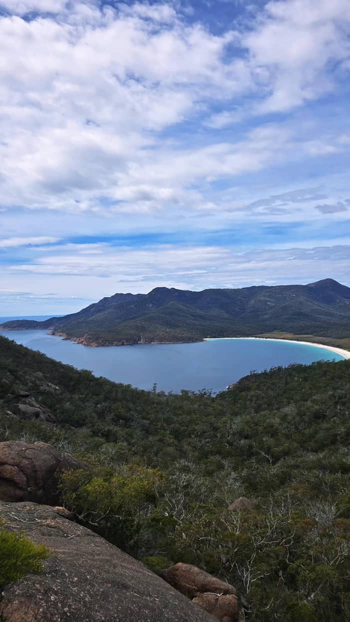
Calm water
Sea kayak
Great Oyster Bay
- Length3 hours
- FromMuirs Beach
- AgeNot under 7
Guides
Language
Currency
Check open spotsfrom $110 · no cancel feeYour stop on the map
See all 22 stops
Select a route, then tap a marker or stop to see its note and open Google Maps.
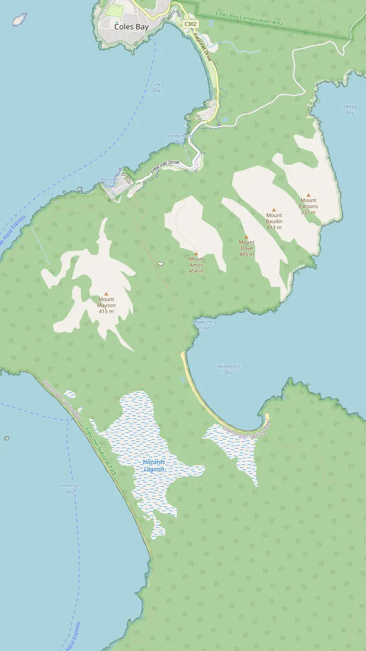
The walks car park has toilets and a water tap; the lookout track starts here.
Google MapsThe lookout platforms sit on the saddle, in a pass through the Hazards.
Google MapsMount Amos: 3 hours return over 3.6km, Grade 4, never when wet.
Google MapsThe beach is approximately 1000 stairs below the saddle.
Google MapsThe isthmus between the two beaches is an unusually wide tombolo.
Google MapsHazards Beach is the halfway point of the 11km circuit.
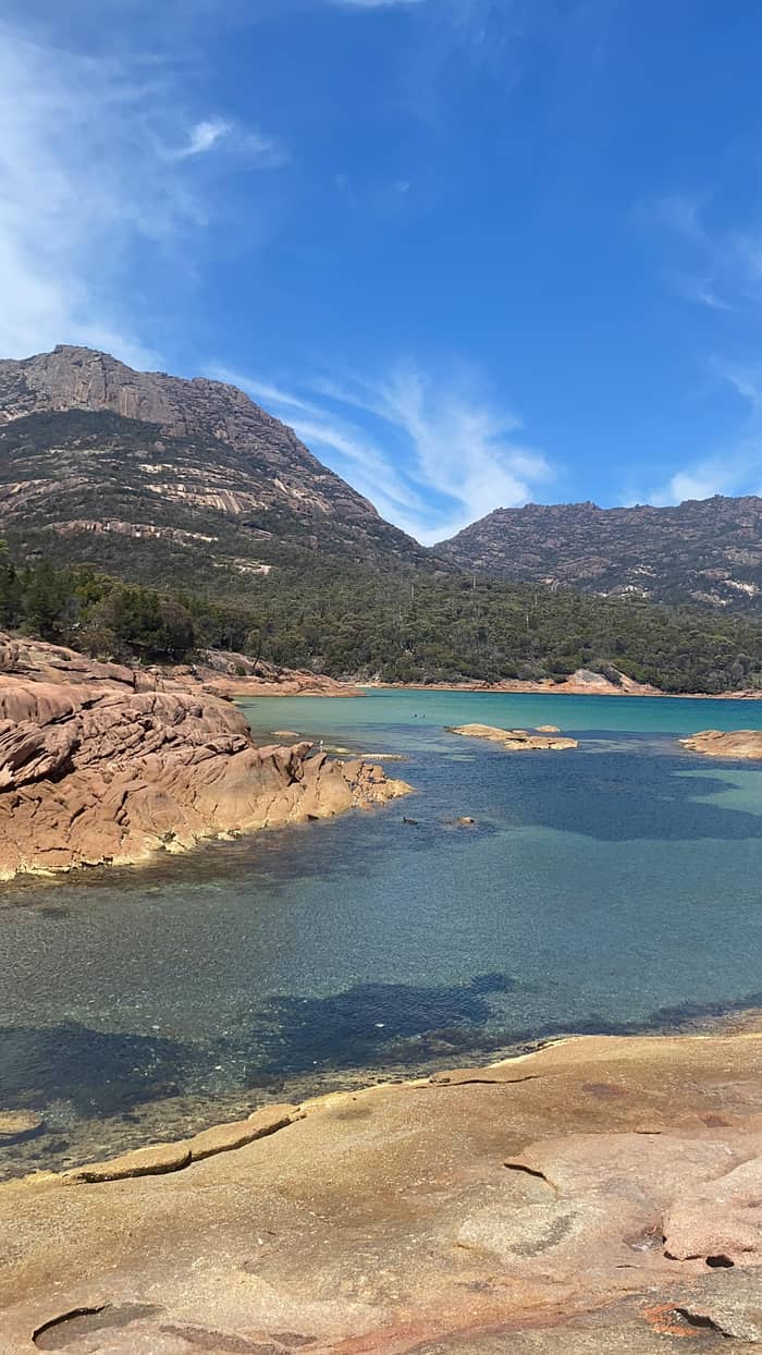
Google MapsThe walker campsite at the bay needs no booking and charges nothing.
Google Maps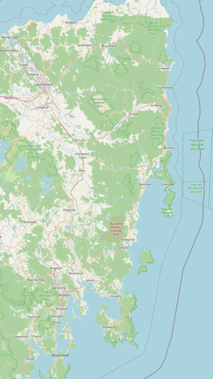
Hobart: Freycinet National Park is a 2hr 30min drive (195km) to the north-east.
Google MapsRichmond is the village this site's tour visits for 30 minutes on the way back to Hobart.
Google MapsSwansea looks across Great Oyster Bay to the pink peaks of the Hazards.
Google MapsColes Bay is the peninsula's sole town and the gateway to the park.
Google MapsBicheno is 39km, about 30 minutes, from Freycinet.
Google MapsLaunceston: the park is a 2hr drive (175km) to the south-east.
Google Maps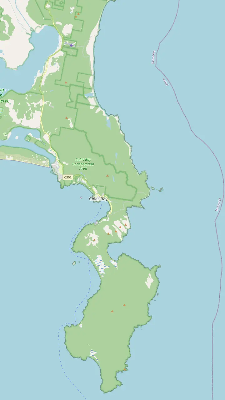
The visitor centre at the park entrance opens daily from 9am to 4pm and sells park passes.
Google MapsThe Friendly Beaches: more than 10km of sand; swimming is not recommended.
Google MapsCape Tourville: a 20 minute, 600m boardwalk circuit around the lighthouse.
Google MapsSleepy Bay: 20 minutes return over 500m, to turquoise water and orange rocks.
Google MapsHoneymoon Bay: barbecues, picnic tables and a good sunset view of the Hazards.
Google MapsRichardsons Beach: the campground beside one of the east coast's most extensive shell middens.
Google MapsThe lookout platforms sit on the saddle, in a pass through the Hazards.
Google MapsCooks Beach has a small walker campsite on the peninsula circuit.
Google MapsMount Freycinet is the highest point on the peninsula.
Google MapsBluestone Bay lies on the park's ocean coast north of Cape Tourville.
Google Maps© OpenStreetMap contributors, map data
The lookout is only the start of things to do at Wineglass Bay. Short walks to a lighthouse and quiet coves, a long white beach, kayaks, boats, flights and wildlife fill the rest of a day or a week on the peninsula.
Editorial team, freycinetnationalparktour.com · Updated November 8, 2026 · Quick read: 8 min
Cape Tourville in Freycinet National Park gives a big view for very little effort. The parks service rates its loop Grade 1: a 20 minute, 600m circuit on a flat, even surface with no steps.1 It is suitable for wheelchair users who have someone to help them, which makes it the place to bring anyone who cannot manage the lookout climb.5 To get there, turn left off the main park road onto the Cape Tourville Road.6
A raised walkway circles the automated lighthouse, and long stretches of boardwalk run right out to the cliff edge.7,8 From it you look across to the Hazards, into Wineglass Bay and out to the offshore rocks called The Nuggets.9 Discover Tasmania calls The Nuggets a wreck-magnet.10 Bring binoculars: the parks service lists sea birds, sea-eagles, whales, seals and dolphins among the animals seen from here.11
Whale season is a good reason to linger. Discover Tasmania says that from about May to November you have a chance of humpback and southern right whales passing the cape, and boardwalk markers give a sense of their size.12 The loop lies about 7 km from the visitor centre, short enough to combine with the lookout in a morning.13 On this site's Hobart day tour, the lighthouse and its lookout get a 20-minute stop.
Places compared
| Place | Walk | Grade | Good for |
|---|---|---|---|
| Cape Tourville | 600m circuit | Grade 1 | Whales, wheelchairs |
| Sleepy Bay | 500m return | Grade 3 | Rocks and color |
| Honeymoon Bay | Short stroll | Not graded | Picnics, sunset |
| Friendly Beaches | 100m to 5km | Grade 2 | Long beach walks |
| Lookout | 2.6 km return | Grade 3 | The classic view |
Walk lengths and grades from the parks service's pages for each place.1,2,16,25,15
Sleepy Bay sits off the same Cape Tourville road, with its own car park. The walk is 20 minutes return over 500m, rated Grade 3, down gently graded steps to a rocky shore.2 The name is misleading: the parks service notes that the bay often has wild and rough seas.17 What you come for is the color, turquoise water against orange lichen on the boulders.18 On a stormy day the swell breaking on the rocks is a show of its own.
Keep going if you have a little more time. The track continues for another 10 minutes beyond the bay, with coastal views, before a steep descent to a small cove.19 It is easy to follow but rough underfoot in places, and it passes close to high cliff tops, so hold small children's hands.20 Discover Tasmania describes Sleepy Bay as a tiny beach between pink granite outcrops that sees beautiful sunrises.21
These short coastal walks bring Freycinet's granite right up close. The management plan ranks the Hazards above anywhere else in Tasmania for weathered granite on a large scale, and the shapes at Sleepy Bay show what that means: rounded boulders, flaking slabs and colors that change with the light.22 Swimming is not the point here; with rough water and steep rock, treat it as a place to look and photograph.
Honeymoon Bay is the park's gentle side, a small cove close to the visitor centre on the sheltered Great Oyster Bay shore. Discover Tasmania suggests it as a quieter alternative to Wineglass Bay and a fine spot for sunset, when the last light sets the Hazards aglow.27,3 You will find electric barbecues, picnic tables and toilets here, plus a tap for water.15,28 This site's tour from Hobart spends 30 minutes at Honeymoon Bay.
Coles Bay walks range from short beach strolls to the long hikes of the peninsula. Discover Tasmania says the trails range from 10min beach walks right up to hikes of several days around the peninsula.29 The easiest link is the Freycinet Walk and Cycle Track: from Ranger Creek it is 2 km to Honeymoon Bay, 30 mins on foot or 15 mins by bike.24 Along the way you see the lower slopes of Mount Baudin, Mount Dove and Mount Amos.30
The shore here carries deep history. The parks service notes that the Richardsons Beach campground sits next to a shell midden among the largest recorded on the east coast, a place that still matters deeply to the Tasmanian Aboriginal community.31,32 Walk on the sand, not the dunes, and leave shells where they lie. The visitor centre also has a 10 minute wheelchair-accessible circuit track starting beside it.23
Plan your extras
Match the activity to your energy, budget and companions.
If I have little time and want a big view
Cape Tourville
If I would rather look at the bay from a boat
The cruise
The catamaran rounds the peninsula into Wineglass Bay.26
If I like paddling
Kayak tour
3 hours below the Hazards from Muirs Beach.
If I want empty sand
Friendly Beaches
More than 10km of beach in a separate park section.4
If I am travelling with a wheelchair user
Cape Tourville
Suitable for wheelchair users with assistance.5
Paid experiences
Calm water
Great Oyster Bay
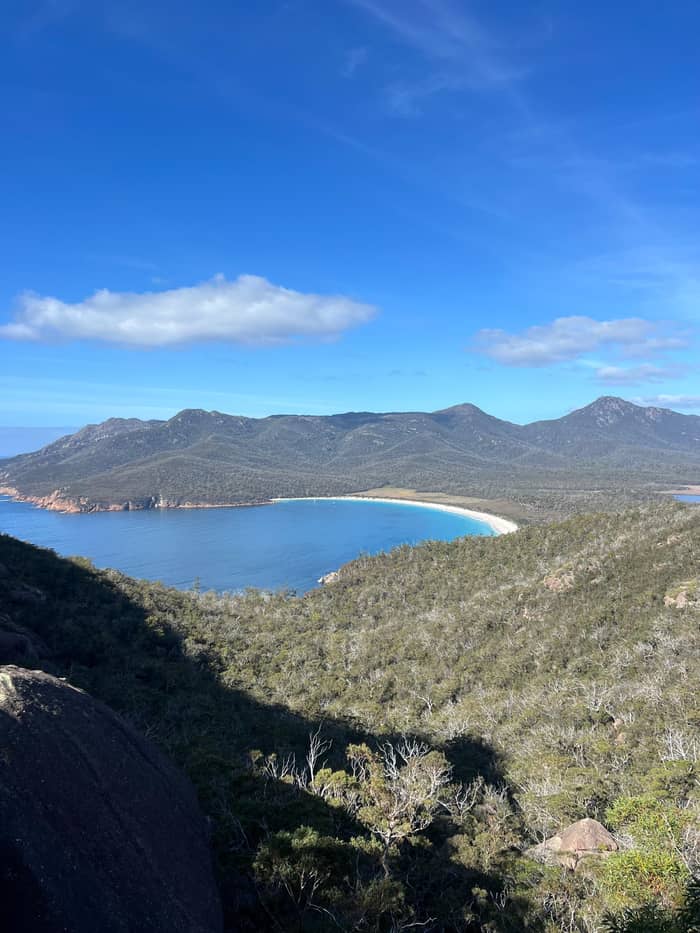
Into the bay
Into Wineglass Bay
From above
Peninsula and Maria Island
North of Coles Bay, a separate section of the park holds the Friendly Beaches, reached by a gravel road about 9km after you leave the Tasman Highway.55 Discover Tasmania puts the sand at more than 10km, with lagoons pooled behind the beaches.4 The beaches were added to the national park in 1992, and they make a change of pace from the famous bay to the south.56 Come in the late afternoon and the granite headlands glow behind you as you walk.
You can walk as little or as much as you like. The parks service lists walks of 5 minutes to 5 hours, from 100m to 5km, rated Grade 2 and suitable for most ages.16 When the surf is up, surfers try the breaks, and the beach suits surf fishing.57 Swimming is a different matter: the parks service advises against it here, and nobody patrols these beaches.39 Paddle at the edge on a calm day, and keep children out of the surf.
For a night by the sea, Isaacs Point at the Friendly Beaches offers basic camping with no reservations, where whoever arrives first takes a site, for up to 14 nights.58 There is no camping charge and no booking, but there are only pit toilets and no fresh water.59,60 Bring all your water and a fuel stove, and expect a sky full of stars on a clear night. Arrive early in summer to pick a sheltered site among the scrub.
Price check
Pick a group size and the from-prices of every option add up for you.
Compare all 4 options
Pick a group size and the from-prices of every option add up for you.
≈
View≈
View≈
View≈
ViewFigures are GetYourGuide from-prices, translated at the ECB reference rate. The booking step shows what you pay exactly.
A full day
Early
Walk up before the midday rush.14
Late morning
The 20 minute circuit around the lighthouse.1
Midday
A 20 minute return walk to the rocks.2
Lunch
Barbecues and picnic tables by the water.15
Afternoon
Walk the long sand for as long as you like.16
Sunset
Watch the Hazards glow.3
Kayaking shows the Hazards from below. Discover Tasmania describes a 3hr guided kayak tour across the toes of the Hazards with a stop ashore at Honeymoon Bay.61 The bookable version leaves from Muirs Beach in Coles Bay with a live English guide, double kayaks, warm jackets and a hot drink break; children under 7 cannot join, and it is listed from $109. It is a calm-water paddle on Great Oyster Bay, not an ocean crossing into Wineglass Bay itself.
Without your own boat, a cruise is how you get the view from the water, and the granite cliffs look even taller from sea level. Discover Tasmania describes a catamaran trip from Coles Bay that rounds the tip of the peninsula into Wineglass Bay for lunch.26 It calls this the rarest view of the bay, often with dolphins for company.62 The bookable cruise from Coles Bay runs 4.5 hours with live commentary in English, from $133.
From the air the whole peninsula makes sense at once. Discover Tasmania says Freycinet scenic flights range from 30-minute spins over Wineglass Bay to hour-long trips out to Maria Island.63 A longer listed option flies from Cambridge near Hobart over the peninsula to Maria Island in 3 hours, from $349. On land, guided ATV buggy tours run out to the southern Friendly Beaches or to Cape Tourville, and Freycinet Marine Farm just outside Coles Bay serves oysters and mussels from its own farm.64,65
Video
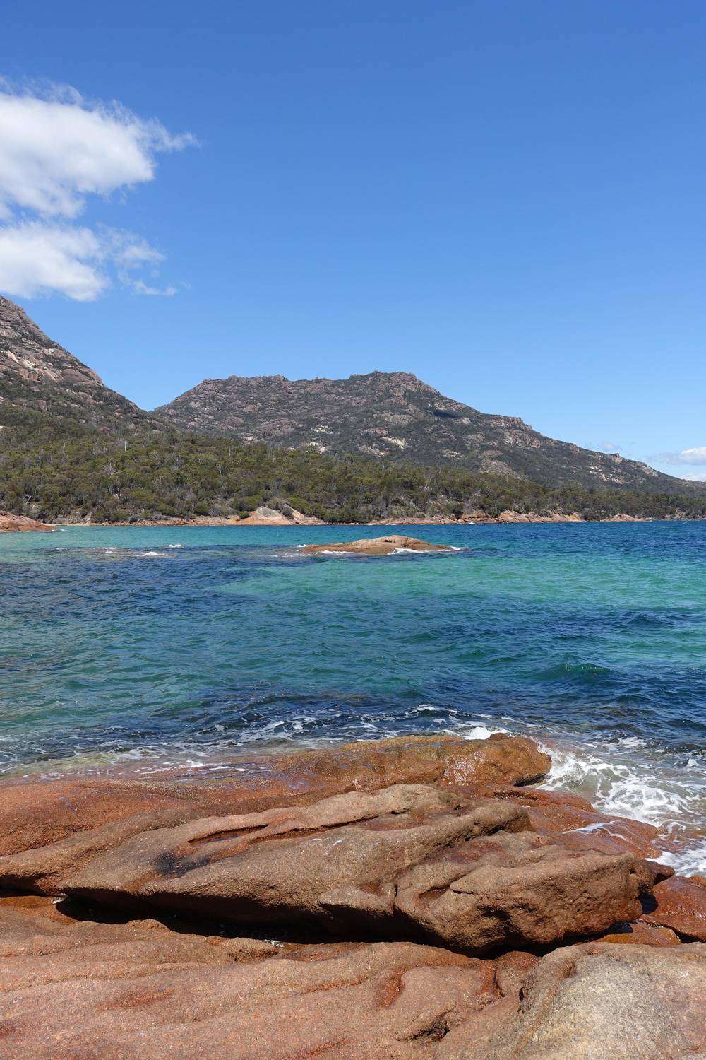
Wander Explore Discover on YouTube · Tap play to load the video; not before.
Much of the walk is on a raised boardwalk which, at times, takes you right to the cliff edge, offering amazing views
Before you go
Freycinet is easy wildlife country, and you rarely need to go looking. On land, Bennetts wallabies, pademelons and echidnas turn up often, the parks service says, while seals haul out on the shoreline rocks.66 Around Coles Bay, Discover Tasmania adds wombats and white-bellied sea eagles to the list.67 Scan the sky from the lookouts at Wineglass Bay and Cape Tourville for white-bellied sea-eagles, and the sea for Australasian gannets plunging after fish.68
Whales are the seasonal highlight. The parks service says the waters off the peninsula are regularly visited by whales, particularly humpbacks, during the winter months.69 Flowers are a quieter pleasure: the parks service finds wildflowers and orchids in bloom through most of the year, and Discover Tasmania says native orchids are most prolific in October and November.70,71 Look down as often as you look out to sea.
Watch animals without changing their behavior. Keep a gap of two metres or more from any native animal and never offer food, the parks service asks.53 After dark, slow right down or stay off the road: wildlife strays onto the bitumen from dusk to dawn, and the parks service would rather you did not drive its reserves at night.72,54 For penguins, Bicheno is 39km, about 30 minutes, north of the park, and Bicheno Penguin Tours runs nightly.36,73
When you plan what to see in Freycinet National Park with children, start with the flat and short. Cape Tourville is Grade 1, with no steps or steep sections, and the Friendly Beaches walks are Grade 2 and suitable for most ages.1,16 The 10 minute accessible circuit beside the visitor centre is ideal for small legs.23 Honeymoon Bay adds barbecues and picnic tables for lunch.15 Shallow, sheltered water there makes paddling at the edge more relaxed than on the ocean beaches.
Some outings have age limits or warnings. The parks service steers young children away from Mount Amos, the kayak tour takes nobody under 7, and this site's tour from Hobart starts at 8 years.74 The lookout is a steep Grade 3 track with many steps; families can manage it with rest stops, but plan for the upper end of its 1-1.5 hours return.75,25 Pack snacks for the seats on the way up.
Wherever you go, keep children close near cliffs and water. The parks service flags dangerous cliffs and unguarded beaches and wants every child kept under watch.76 Families who need help with mobility can book the TrailRider all-terrain wheelchair through the visitor centre, free of charge.77 Pets stay home: dogs are generally not allowed in national parks, though assistance dogs are.78
FAQ
The parks service lists the Hazards, Wineglass Bay and The Nuggets among the sights from the Cape Tourville circuit.9
The 3hr guided paddle crosses below the Hazards with a stop at Honeymoon Bay.61
Discover Tasmania gives a May to November window for humpbacks and southern rights off the cape.12
Swimming there is advised against, and no lifeguards patrol the sand.39
Discover Tasmania suggests Honeymoon Bay for sunset, with the Hazards lit up.3
Sources
More to read
Planning a day at Wineglass Bay? A real person answers here.