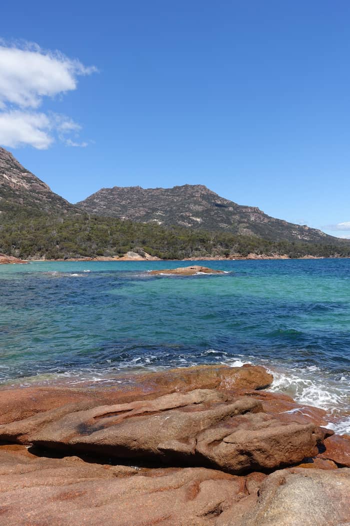
Shortest walk
There and back
Over the saddle
- Distance6 km return
- Time2.5-3.5 hrs
- FacilitiesComposting toilet
Guides
Language
Currency
Check open spotsfrom $110 · no cancel feeYour stop on the map
See all 22 stops
Select a route, then tap a marker or stop to see its note and open Google Maps.
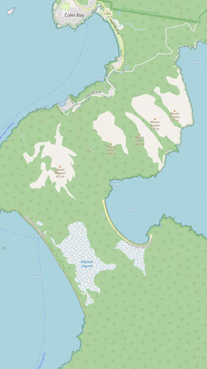
The walks car park has toilets and a water tap; the lookout track starts here.
Google MapsThe lookout platforms sit on the saddle, in a pass through the Hazards.
Google MapsMount Amos: 3 hours return over 3.6km, Grade 4, never when wet.
Google MapsThe beach is approximately 1000 stairs below the saddle.
Google MapsThe isthmus between the two beaches is an unusually wide tombolo.
Google MapsHazards Beach is the halfway point of the 11km circuit.
Google MapsThe walker campsite at the bay needs no booking and charges nothing.
Google Maps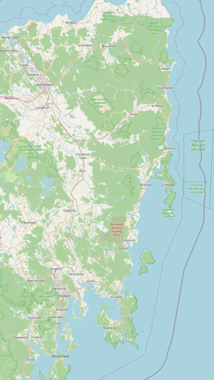
Hobart: Freycinet National Park is a 2hr 30min drive (195km) to the north-east.
Google MapsRichmond is the village this site's tour visits for 30 minutes on the way back to Hobart.
Google MapsSwansea looks across Great Oyster Bay to the pink peaks of the Hazards.
Google MapsColes Bay is the peninsula's sole town and the gateway to the park.
Google MapsBicheno is 39km, about 30 minutes, from Freycinet.
Google MapsLaunceston: the park is a 2hr drive (175km) to the south-east.
Google Maps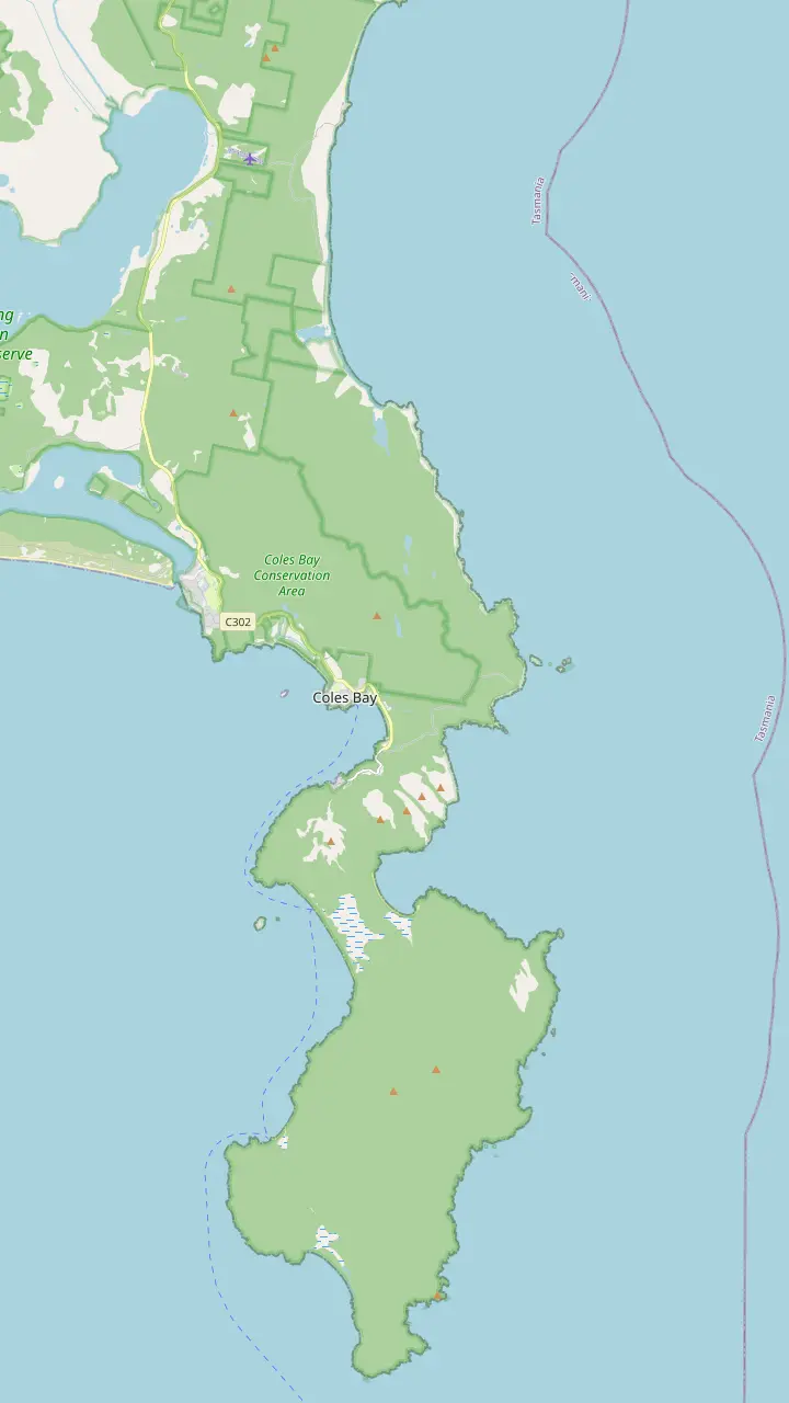
The visitor centre at the park entrance opens daily from 9am to 4pm and sells park passes.
Google MapsThe Friendly Beaches: more than 10km of sand; swimming is not recommended.
Google MapsCape Tourville: a 20 minute, 600m boardwalk circuit around the lighthouse.
Google MapsSleepy Bay: 20 minutes return over 500m, to turquoise water and orange rocks.
Google MapsHoneymoon Bay: barbecues, picnic tables and a good sunset view of the Hazards.
Google MapsRichardsons Beach: the campground beside one of the east coast's most extensive shell middens.
Google MapsThe lookout platforms sit on the saddle, in a pass through the Hazards.
Google MapsCooks Beach has a small walker campsite on the peninsula circuit.
Google MapsMount Freycinet is the highest point on the peninsula.
Google MapsBluestone Bay lies on the park's ocean coast north of Cape Tourville.
Google Maps© OpenStreetMap contributors, map data
Wineglass Bay beach is a steep walk past the lookout, down a long staircase to white sand. This guide covers the walk there and back, swimming, the full loop via Hazards Beach, the boat shortcut and nights in the walkers' campsites.
Editorial team, freycinetnationalparktour.com · Updated November 8, 2026 · Quick read: 8 min
The walk to the beach begins as the lookout walk does, on the steep track up from the walking tracks car park. At the saddle, instead of turning back, you keep going: approximately 1000 stairs lead down the far side to the sand.2 The parks service rates the whole outing Grade 3, with steep sections, and recommends walking boots and some bushwalking experience.1,7 Unlike the lookout, this is a proper walk, not a stroll with a view at the end.
How long is the walk to Wineglass Bay? The parks service gives 2.5-3.5 hrs return for 6 km, and its walk-time table gives the same trip from the car park to the bay and back as 2 hours 30 mins to 3 hours 30 mins in total.1,8 Those figures leave little time on the sand, so if you want to swim, picnic or wander, add an hour or more. The climb back up the staircase is the hardest part of the day, and it comes when your legs are already tired.
The parks service says plainly that this demanding outing does not suit every visitor.9 Walkers with less fitness should give themselves more time and stop to rest often, it advises.10 Coming back the way you came is the shortest and easiest route, which is worth remembering if the day turns hot or a member of your group tires.11 There is no shame in stopping at the lookout and enjoying the bay from above instead.
Ways onto the sand
| Option | Distance | Time | Grade |
|---|---|---|---|
| There and back | 6 km | 2.5-3.5 hrs | Grade 3 |
| Full circuit | 11km | 4-5 hours | Grade 4 |
| Water taxi and isthmus | 2 km walk | 30-minute boat | Isthmus Track |
| Peninsula circuit | 27km | 2 - 3 days | Grade 3 |
From the parks service's walk pages and the water taxi listing.1,3,22
Once you are down, Wineglass Bay beach is a long sweep of white sand with clear water and granite at both ends. The parks service recommends carrying on for another 20-minute walk down the sand to the far southern end, where the Hazards line up behind the curve of the bay.17 That view, with the peaks you crossed rising behind the beach, is worth the extra walk, and the far end of the sand often feels emptier than the patch below the stairs.
Facilities are minimal by design. There is nothing along the track until the bay, where a composting toilet waits near the beach.5 There are no bins at the beach, and everything you bring in has to go back up the stairs with you.6 The area is fuel stove only and fires are prohibited, which rules out a beach barbecue but not a picnic.18 Pack lunch, water and a bag for rubbish, and the day takes care of itself.
The beach has a reputation well beyond Tasmania. Wineglass Bay sits at #21 on the 2026 ranking of the World's 50 Best Beaches drawn up by over 1000 travel professionals and creators.19 The sea adds its own interest: in the migration months, whales and dolphins sometimes appear in the bay.20 Bring a light layer even in summer, since a sea breeze can cool the sand quickly once the sun drops behind the Hazards.
Can you swim in Wineglass Bay? Yes, with care. The parks service describes paddling in the clear water after you come down from the lookout, and its circuit notes warn that the beaches are unpatrolled, so swim with care.13,4 There are no lifeguards and no flags here. Swim close to shore, stay within your depth, and keep watching the water rather than your phone. If a swell is running or the wind is onshore, settle for a paddle at the edge.
Summer is when swimming makes most sense. Discover Tasmania's seasonal guide pictures summer days drifting in the turquoise shallows and lazing on the bay's white sand.26 The parks service does not publish a water temperature for the bay, so expect the open ocean to feel cool and ease in slowly. Wading to your knees is enough to see the color of the water up close, and it keeps you near the shore.
Children need constant watching on these beaches. The parks service lists unpatrolled beaches among the park's hazards and asks that children be supervised at all times.27 Conditions vary along the coast as well: at the Friendly Beaches, further north in the park, the parks service says swimming is not recommended at all.28 Wineglass Bay's sheltered curve is a calmer place to get wet, but treat it as wild water all the same.
Choose your day
Your fitness, your time and the weather decide the route.
If I want the beach but have half a day
There and back
6 km return in 2.5-3.5 hrs by the parks service's figures.1
If I want the whole loop and I am fit
The circuit
11km over 4-5 hours, Grade 4.3
If Stairs are hard on my knees
Water taxi
A 30-minute boat ride, then a 2-kilometre walk.
If I want the bay at dawn
Camp overnight
If It is a Total Fire Ban day
No stove at all
No naked flames of any kind, including fuel stoves.25
Three ways to the beach
Shortest walk
Over the saddle
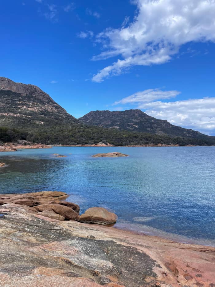
Most scenery
Via Hazards Beach
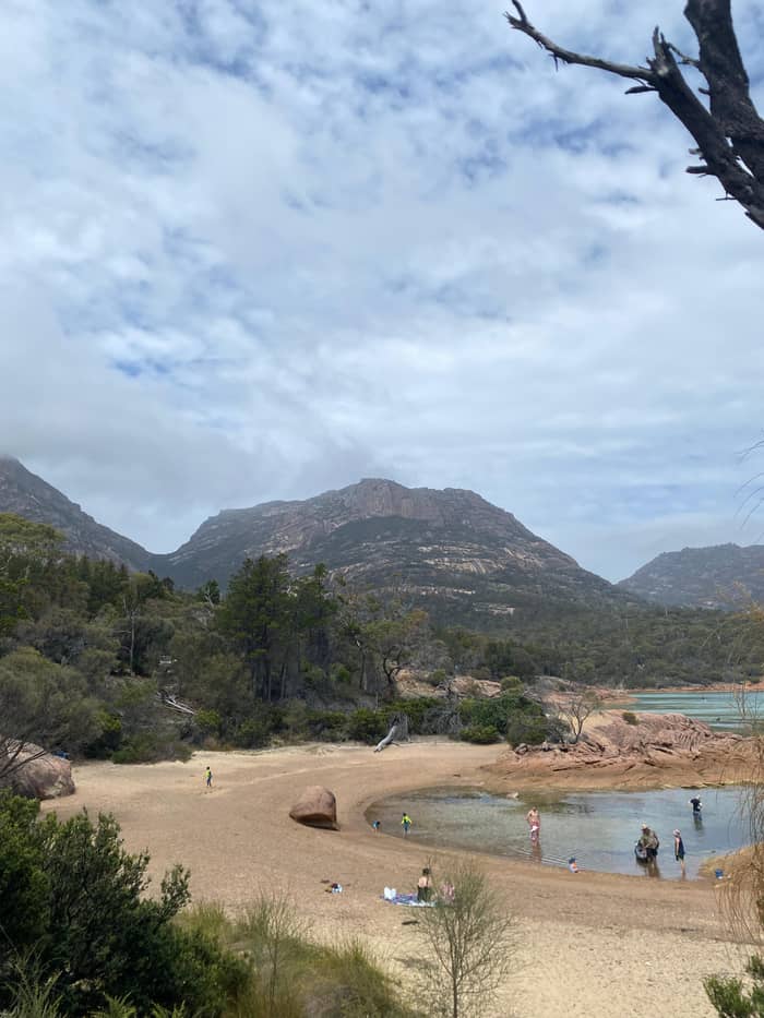
Fewest stairs
Boat to Hazards Beach
The Wineglass Bay and Hazards Beach circuit turns a return walk into a loop. The parks service gives it as 11km over 4-5 hours, rated Grade 4, with long, rough and very steep sections and limited signage.3,48 Discover Tasmania counts it among Tasmania's 60 Great Short Walks.49 From Wineglass Bay you cross the wide isthmus behind the beach to the long sandy stretch of Hazards Beach on the other side.14
That isthmus is the most interesting ground on the walk. The park's management plan calls the sand bar between Wineglass Beach and Hazards Beach a tombolo, and an unusually wide, well developed one, backed by dunes and lagoons.46 Walking along Hazards Beach brings you to the halfway point of the loop.15 The beach faces west across Great Oyster Bay, a different mood from the ocean side, with the peaks now to your north.
The second half climbs inland through she-oak forest with glimpses across Great Oyster Bay, then rounds Mount Mayson through coastal woodland, dipping into seasonal creeks.50,16 The parks service admits that this last stretch can feel longer than it should.51 Keep water in reserve for it, and start the loop early enough to finish in daylight. The track returns along the rocky coast to the car park.
The circuit in order
Car park
Refill bottles at the car park tap before the climb.12
The saddle
Approximately 1000 stairs lead to the beach.2
Wineglass Bay
Rest, walk the sand and paddle in the clear water.13
The isthmus
Cross the wide isthmus to Hazards Beach.14
Hazards Beach
Walking the beach brings you to halfway.15
Mount Mayson
Round Mount Mayson through woodland and creeks.16
There is a shortcut for walkers who want the sand without the full climb. A water taxi runs from the Coles Bay Boat Ramp on Garnet Avenue to Hazards Beach: the listing names a 30-minute cruise, then a 2-kilometre walk on the Isthmus Track to Wineglass Bay. It is listed from $91, with free cancellation up to 24 hours in advance and no age or height limits. That puts Wineglass Bay beach within reach of walkers who would struggle with the staircase.
A guided version combines both. A small-group walk and boat day from Freycinet Lodge lasts 5.5 hours, with up to 8 participants and a live English guide. Its plan takes in the lookout, then morning tea down on the sand of Wineglass Bay, a packed lunch at Hazards Beach and the boat back to the jetty at the lodge. It needs at least 4 guests per departure, provides a day pack, water bottle, rain jacket and sunscreen, and is listed from $176.
Either boat option spares you the climb back over the saddle. You still walk the isthmus, which is flat sand and track, and you still see both beaches. If you are on this site's tour from Hobart, note that its day includes the lookout walk and Honeymoon Bay but not the descent to the beach. For the sand itself, plan a separate day on the peninsula or use the water taxi.
Video
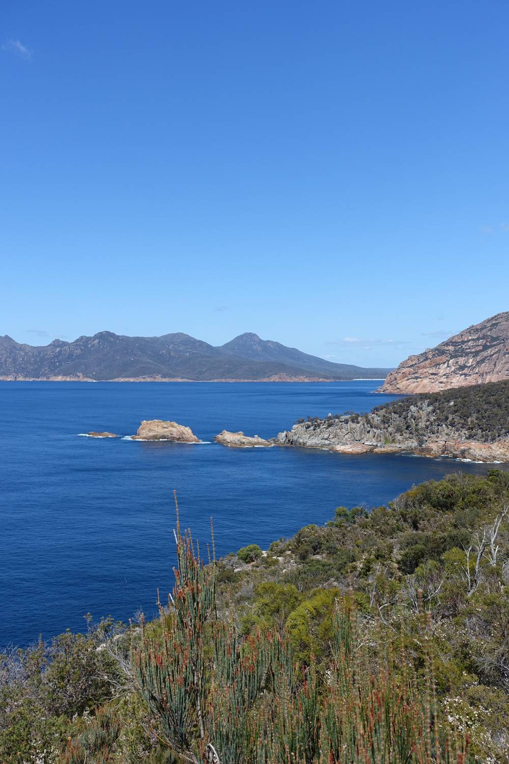
Tasmania Unearthed on YouTube · Tap play to load the video; not before.
After descending from the lookout to Wineglass Bay, take your time, enjoy a picnic, walk on the beach and paddle in the crystal-clear waters
For the sand
An overnight hike in Freycinet National Park lets you see the bay at dawn with almost nobody around. The parks service runs small walker campsites at Cooks Beach, Hazards Beach and Wineglass Bay, with no camping charge and no bookings required.23,24 Every one of these campsites has a composting toilet.52 Discover Tasmania confirms that overnight walkers can use these walk-in campsites without booking ahead.53
Water is the main planning problem. The collection points are a tap at the walking tracks car park and a tank at Cooks Hut, and the parks service warns that the tank may hold no water.54 Carry what you need from the car park, and boil any water you collect before drinking it, as the parks service advises.55 Freycinet is a fuel stove only area; on days of Total Fire Ban no naked flame of any kind is allowed in the open, gas and fuel stoves included.18,25
For a longer route, the Freycinet Peninsula Circuit takes 2 - 3 days over 27km from the Wineglass Bay car park.22 Walk it anti-clockwise, down the western side, which the parks service asks of everyone to slow the spread of Phytophthora root rot.56 Parks advises that the east coast's climate is kinder than the rest of Tasmania's, and that makes the circuit worth considering in winter too, when creek water is often more dependable.57,58 Sign the walker log book with your route before setting out.59
Water comes first. The park has little drinking water, and taps are found only at the visitor centre, Honeymoon Bay and the walking tracks car park.60,12 For the beach walk, carry more than you think you need, since the climb back up the stairs is thirsty work and there is no tap at the bay. Freeze a bottle overnight if you can. Sun protection matters as well: by Discover Tasmania's account, UV runs high from September to April.47
Dress for change. The parks service notes that Tasmanian conditions can change at any time of year, and Discover Tasmania advises carrying extra warm clothing with a waterproof outer layer.61,62 Wear walking boots rather than sandals for the stairs and the granite; Freycinet walks are often on steep rock and loose gravel.63 Swimmers should pack a towel light enough to carry back up, and a dry layer for the climb.
Respect what lives here. Possums will investigate unattended bags, and feeding wildlife makes animals sick.64,65 Drones are banned in Tasmanian national parks, and dogs are generally not allowed.66,67 Take every scrap of rubbish home, since there are no bins on the beach.6 A valid parks pass is needed to enter the park in the first place.68 Leave the shells, sand and stones where they lie for the next walker to find.
FAQ
From the car park it is 6 km there and back, 2.5-3.5 hrs, on a Grade 3 track.1
Roughly 1000 stairs separate the saddle from the sand, and every one has to be climbed again later.2
The parks service says the beaches are unpatrolled and asks walkers to swim with care.4
There are no facilities on the track, but there is a composting toilet at the bay.5
A water taxi runs to Hazards Beach, then a 2-kilometre walk on the Isthmus Track leads to Wineglass Bay.
Sources
More to read
Planning a day at Wineglass Bay? A real person answers here.