Living culture
Oyster Bay country
The first people
- PeopleOyster Bay nation
- Clantoorerno-maire-mener
- TracesMiddens, quarries
Guides
Language
Currency
Check open spotsfrom $110 · no cancel feeYour stop on the map
See all 22 stops
Select a route, then tap a marker or stop to see its note and open Google Maps.
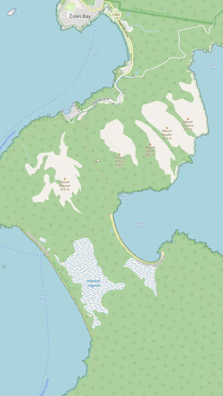
The walks car park has toilets and a water tap; the lookout track starts here.
Google MapsThe lookout platforms sit on the saddle, in a pass through the Hazards.
Google MapsMount Amos: 3 hours return over 3.6km, Grade 4, never when wet.
Google MapsThe beach is approximately 1000 stairs below the saddle.
Google MapsThe isthmus between the two beaches is an unusually wide tombolo.
Google MapsHazards Beach is the halfway point of the 11km circuit.
Google MapsThe walker campsite at the bay needs no booking and charges nothing.
Google Maps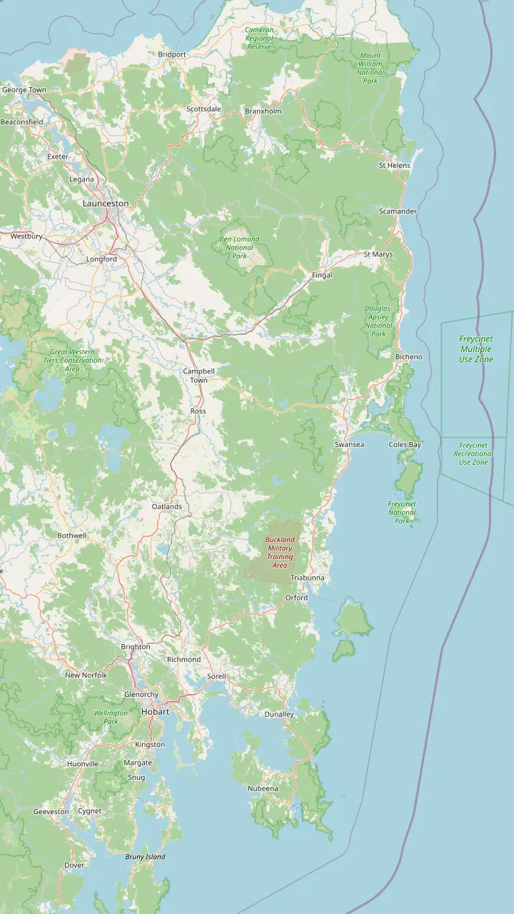
Hobart: Freycinet National Park is a 2hr 30min drive (195km) to the north-east.
Google MapsRichmond is the village this site's tour visits for 30 minutes on the way back to Hobart.
Google MapsSwansea looks across Great Oyster Bay to the pink peaks of the Hazards.
Google MapsColes Bay is the peninsula's sole town and the gateway to the park.
Google MapsBicheno is 39km, about 30 minutes, from Freycinet.
Google MapsLaunceston: the park is a 2hr drive (175km) to the south-east.
Google Maps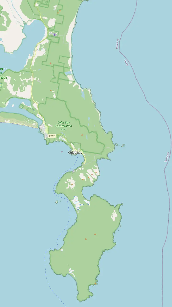
The visitor centre at the park entrance opens daily from 9am to 4pm and sells park passes.
Google MapsThe Friendly Beaches: more than 10km of sand; swimming is not recommended.
Google MapsCape Tourville: a 20 minute, 600m boardwalk circuit around the lighthouse.
Google MapsSleepy Bay: 20 minutes return over 500m, to turquoise water and orange rocks.
Google MapsHoneymoon Bay: barbecues, picnic tables and a good sunset view of the Hazards.
Google MapsRichardsons Beach: the campground beside one of the east coast's most extensive shell middens.
Google MapsThe lookout platforms sit on the saddle, in a pass through the Hazards.
Google MapsCooks Beach has a small walker campsite on the peninsula circuit.
Google MapsMount Freycinet is the highest point on the peninsula.
Google MapsBluestone Bay lies on the park's ocean coast north of Cape Tourville.
Google Maps© OpenStreetMap contributors, map data
Why is it called Wineglass Bay? Tasmania's tourism body traces it to the whaling era, when the water ran red. Here is that story, the people who were here first, the French names on the map and the park that protects it all.
Editorial team, freycinetnationalparktour.com · Updated November 8, 2026 · Quick read: 8 min
The curve of the bay looks so much like the bowl of a glass that the shape seems the obvious explanation. Tasmania's official tourism body tells a darker story. Discover Tasmania writes that the waters off Cape Tourville were once a hunting ground for the island's whaling industry, and that the blood-red sea inspired the name Wineglass Bay.1 Today, it adds, you will find only clear turquoise water there.6
The park's own records back up the whaling past, if not the naming itself. The management plan for Freycinet National Park notes that there were bay whaling stations at Sleepy Bay and at both the north and south ends of Wineglass Bay.2 The plan dates one operation precisely: the station George Meredith set up at Parsons Cove in 1824, known as the Old Fishery, which ran until the mid-1830s.7 Whaling here was a shore industry, carried out from small camps on the beaches.
Other names on the map point the same way. The plan says Slaughterhouse Bay was probably named for its association with the whaling industry.8 Neither the plan nor the parks service gives a date or a person for the naming of Wineglass Bay, and you should treat the blood-red sea as the account Tasmania's tourism body gives rather than a recorded event. What is certain is that the bay you see today was once a place of hard, bloody work.
Names on the map
| Name | Origin | Source |
|---|---|---|
| Schouten Island | Named by Abel Tasman | Park management plan |
| Freycinet Peninsula | Two brothers on Baudin's voyage | Park management plan |
| Cape Baudin · Cape Faure | Named by Baudin's expedition | Park management plan |
| Slaughterhouse Bay | Probably whaling | Park management plan |
| Wineglass Bay | A sea red from whaling | Discover Tasmania |
From the Freycinet National Park management plan and Discover Tasmania.9,4,8,1
Wineglass Bay history did not end with the whaling stations. The parks service lists whaling parties, tin and coal miners and pastoralists among those who lived and worked on the peninsula, and old mine shafts, farmers' huts and the remains of whalers' camps are now part of the park's heritage.13 Little survives of the whaling itself. The management plan describes the remains as very sparse: piles of whalebone, a few bricks, stone fireplaces and hut foundations.14
Farming left its own mark on the shore. In the 1830s Silas Cole, a farm manager from Cranbrook, north of Swansea, built a hut at Coles Bay and burned shells from the huge Aboriginal middens along Richardsons Beach to make lime, which was shipped to Swansea for mortar.15 It is an uncomfortable detail: ancient cultural sites became building material for the colony across the water.
Tourism arrived slowly. A later management plan records holiday shacks built in 1934 on the site now occupied by Freycinet Lodge, used as an army bivouac in World War II; from 1954 until 1990 a family resort called The Chateau ran there before the site was redeveloped as Freycinet Lodge.16 A 2004 plan change provided for rebuilding the track to the Wineglass Bay Lookout, the path most visitors now climb.17
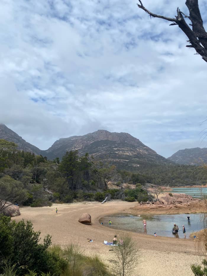
Long before any ship arrived, this was Aboriginal country. According to the parks service, the park sits inside the country of the Oyster Bay nation, whose population is estimated at 600-700 people and whose lands stretched from the Derwent Estuary north along the coast as far as the Fingal Valley, and inland to the Midlands.3 Historic records place the peninsula and Schouten Island within the lands of the toorerno-maire-mener clan.24 Captain James Kelly noted Aboriginal people on Schouten Island in 1816.10
The evidence of that life is still in the landscape. Significant Aboriginal sites lie along the coastlines, dunes and estuaries, among them shell middens, rock quarries, rock shelters and stone artefacts.25 The Richardsons Beach camping ground borders a midden that ranks with the biggest known on the east coast.20 When you walk the beach in front of the campground, you are walking past a long record of meals, tools and camps.
These places are not relics of a vanished people. The parks service stresses that the Tasmanian Aboriginal community keeps a living bond with these sites, and it asks visitors to treat them with respect.26 Keep to the paths, never collect shells or stones from middens, and leave anything that looks like an artefact exactly where it lies. The visitor centre at the park entrance introduces both the natural and the cultural heritage of the region through its displays.23
Follow the story
Each thread of the history has a place where you can stand in it.
If The whaling era
Wineglass Bay and Sleepy Bay
Both held bay whaling stations.2
If Aboriginal heritage
Richardsons Beach, with care
Beside one of the most extensive middens on the east coast.20
If The French names
Cape Tourville and the Hazards
Mount Baudin rises above the walk and cycle track.21
If The geology
The lookout
From there the granite blocks and the tombolo are laid out below.22
If The park's story
The visitor centre
Its displays cover natural and cultural heritage.23
Three chapters
Living culture
The first people
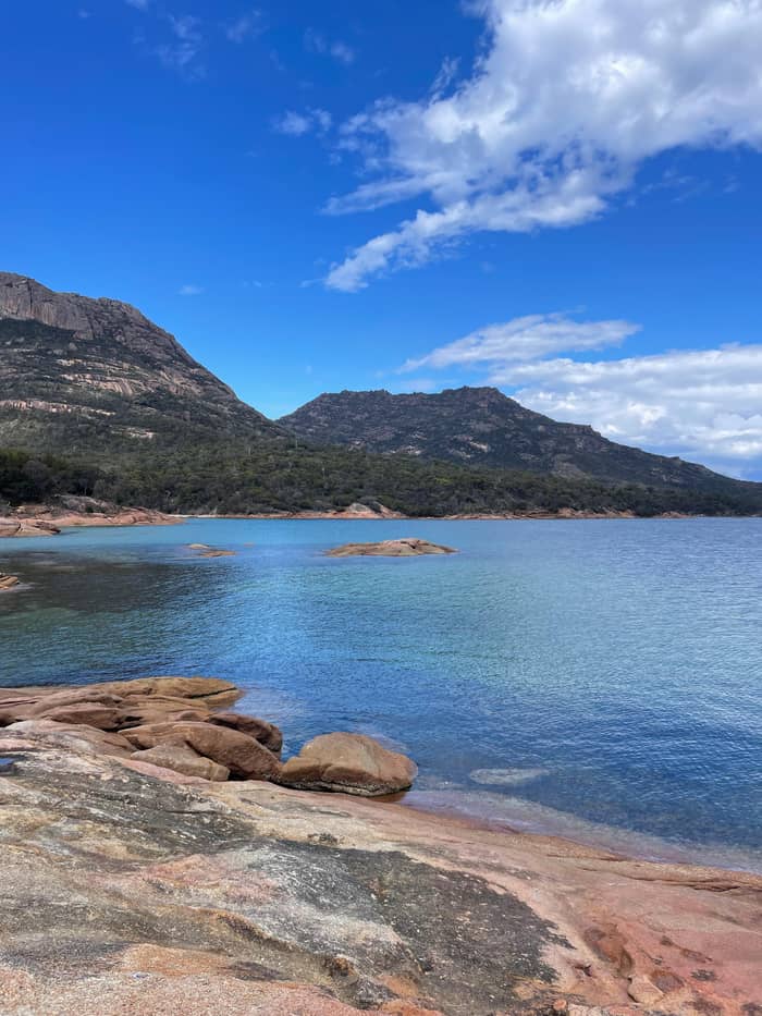
Shore whaling
Stations on the beaches
Oldest in Tasmania
Protected since 1916
European names came in layers. In 1642 Abel Tasman explored Tasmania's southern and south-eastern coast and named Schouten Island, along with a stretch of high ground to the north that he called Vanderlins Eylandt.9 That name did not last. The management plan explains that Vanderlins Eylandt was renamed Freycinet Peninsula after two brothers on Captain Nicolas Baudin's French scientific expedition of 1802.4
Baudin's ships charted the area thoroughly and left a cluster of French names behind: Cape Faure, Cape Baudin, Cape Forestier and Thouin Bay among them.4 Look at a map of the park and you still find the expedition everywhere, on capes, bays and peaks. Mount Baudin, one of the Hazards, rises above the walk and cycle track along with Mount Dove and Mount Amos, and you can see all of them from the gentle path between Ranger Creek and the walks.21
The names tell you who mapped this coast and when, not who knew it first. The Oyster Bay people had their own names for these places long before Tasman sailed past, and those names belong to a living community today. Learning a few of them is a small, real way to show respect while you are here. A visit to Freycinet is a good moment to learn both sets of stories, the charted one and the far older one.
A short history
1642
Tasman names Schouten Island and Vanderlins Eylandt.9
1802
Baudin's voyage renames the peninsula after two brothers.4
1816
Captain James Kelly records Aboriginal people on the island.10
1824
George Meredith opens a whaling station at Parsons Cove.7
1916
The peninsula and Schouten Island become scenic reserves.11
1992
The Friendly Beaches join the national park.12
Whatever its name, the bay owes its shape to rock. According to the parks service, the peninsula took shape over 400 million years: two worn-down masses of granite, the Hazards in the north and Mount Graham with Mount Freycinet in the south, tied together by the sandy isthmus that makes Wineglass Bay.22 The management plan calls this link an unusually wide and well developed tombolo, a bar of sand with dunes and lagoons behind it.46
The peaks are modest in height but striking in form. North of the isthmus rise the Hazards: Mt Parsons (331 metres), Mt Dove (485 metres), Mt Amos (445 metres) and Mt Mayson (420 metres).18 South of it, Mt Graham reaches 579 metres and Mt Freycinet, the highest point on the peninsula, 620 metres.19 The plan calls the Hazards the most outstanding example in Tasmania of large-scale granite weathering and landform development.53
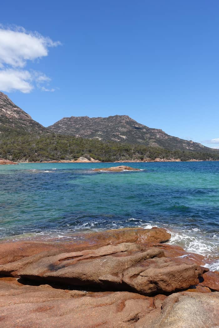
Those rounded domes and orange-stained boulders are what give Freycinet its color, and they change hour by hour. Discover Tasmania describes the park's dramatic pink granite peaks, and in late light they glow above Honeymoon Bay.54,38 Seen from the lookout, the geology is easy to read: granite to the left and right, and between them the long white curve of sand that gave the bay its famous outline.
Video
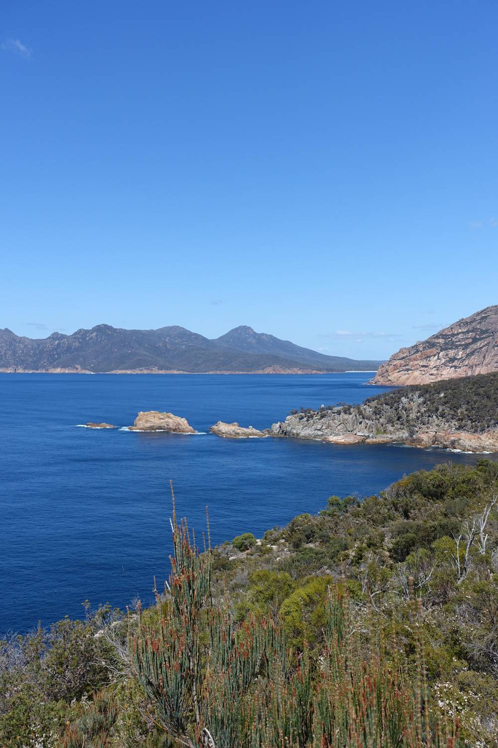
Libraries Tasmania on YouTube · Tap play to load the video; not before.
These waters were once a hunting ground for Tasmania's historical whaling industry - so much so that the blood-red sea inspired the name 'Wineglass Bay'
Visiting with respect
Here are a few facts about Freycinet National Park that explain why the bay still looks untouched today. Set aside as a national park in 1916, it shares with Mount Field the distinction of being Tasmania's oldest.5 The management plan gives the exact date: on 29 August 1916 the Freycinet Peninsula and Schouten Island were gazetted as scenic reserves under the Scenery Preservation Act 1915.11
The park has grown since. The Friendly Beaches joined it in 1992, and the management plan dates that to 29 January 1992, when 1,920 hectares including those beaches came in.12,55 Today the park measures approximately 48 kilometres from end to end, counting Schouten Island, and is at most 6 kilometres across.56 It runs from the Friendly Beaches in the north to Schouten Island in the south.
Protection shapes how you visit. You need a valid parks pass to get in, drones are banned, dogs are generally not allowed and the whole park is a fuel stove only area where fires are prohibited.50,57,58,51 Those rules can feel strict, but they are the price of a bay that still looks wild a century after it was set aside, and of humpback whales that again visit the waters off the peninsula in winter.59
A handful of Wineglass Bay facts are worth knowing before you go, and some of them surprise even people who have seen the photographs. The 2026 World's 50 Best Beaches list, compiled from the votes of over 1000 people working in travel and content creation, placed the bay at #21.60 Discover Tasmania calls it the park's most popular natural feature.61 Its lookout path, a 1.5-hour walk, carries more walkers than any other track in the park.62
The bay is a working wildlife site again. Whales and dolphins pass through the bay on their migrations, and the parks service singles out humpbacks as regular winter visitors.63,59 Discover Tasmania puts the whale-spotting window at Cape Tourville at about May to November, for humpbacks and southern rights alike.52 It is a striking reversal for a bay whose name recalls the whaling stations.
Reaching the sand still takes effort. The sand lies 6 km there and back from the car park, 2.5-3.5 hrs, with approximately 1000 stairs below the saddle.64,45 Looping back over the isthmus via Hazards Beach makes 11km, a route that counts among Tasmania's 60 Great Short Walks.48,65 Walk it slowly and look for the sparse traces the plan describes: a fireplace stone, a scatter of bricks, a story in the sand.
FAQ
Discover Tasmania says the blood-red sea of the whaling days inspired the name.1
Records show bay whaling stations at both the north and south ends of Wineglass Bay.2
It is Oyster Bay nation country; that nation numbered an estimated 600-700 people.3
Vanderlins Eylandt was renamed Freycinet Peninsula after two brothers on Baudin's expedition of 1802.4
It was reserved in 1916 and shares the title of Tasmania's oldest national park with Mount Field.5
The bay is the sand isthmus between two eroded blocks of granite.22
The management plan gives Mt Freycinet as the highest point, at 620 metres.19
Sources
More to read
Planning a day at Wineglass Bay? A real person answers here.