Most walkers
The lookout
The classic view
- Distance2.6 km return
- Time1-1.5 hours
- GradeGrade 3
Guides
Language
Currency
Check open spotsfrom $110 · no cancel feeYour stop on the map
See all 22 stops
Select a route, then tap a marker or stop to see its note and open Google Maps.
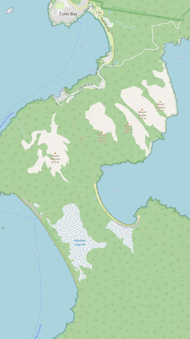
The walks car park has toilets and a water tap; the lookout track starts here.
Google MapsThe lookout platforms sit on the saddle, in a pass through the Hazards.
Google MapsMount Amos: 3 hours return over 3.6km, Grade 4, never when wet.
Google MapsThe beach is approximately 1000 stairs below the saddle.
Google MapsThe isthmus between the two beaches is an unusually wide tombolo.
Google MapsHazards Beach is the halfway point of the 11km circuit.
Google MapsThe walker campsite at the bay needs no booking and charges nothing.
Google Maps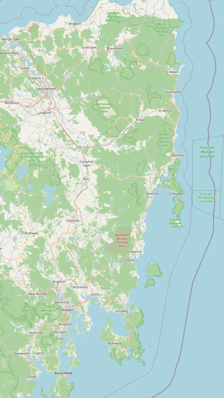
Hobart: Freycinet National Park is a 2hr 30min drive (195km) to the north-east.
Google MapsRichmond is the village this site's tour visits for 30 minutes on the way back to Hobart.
Google MapsSwansea looks across Great Oyster Bay to the pink peaks of the Hazards.
Google MapsColes Bay is the peninsula's sole town and the gateway to the park.
Google MapsBicheno is 39km, about 30 minutes, from Freycinet.
Google MapsLaunceston: the park is a 2hr drive (175km) to the south-east.
Google Maps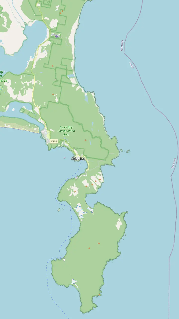
The visitor centre at the park entrance opens daily from 9am to 4pm and sells park passes.
Google MapsThe Friendly Beaches: more than 10km of sand; swimming is not recommended.
Google MapsCape Tourville: a 20 minute, 600m boardwalk circuit around the lighthouse.
Google MapsSleepy Bay: 20 minutes return over 500m, to turquoise water and orange rocks.
Google MapsHoneymoon Bay: barbecues, picnic tables and a good sunset view of the Hazards.
Google MapsRichardsons Beach: the campground beside one of the east coast's most extensive shell middens.
Google MapsThe lookout platforms sit on the saddle, in a pass through the Hazards.
Google MapsCooks Beach has a small walker campsite on the peninsula circuit.
Google MapsMount Freycinet is the highest point on the peninsula.
Google MapsBluestone Bay lies on the park's ocean coast north of Cape Tourville.
Google Maps© OpenStreetMap contributors, map data
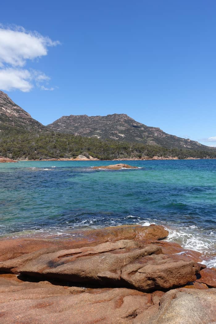
The Wineglass Bay Lookout is the classic view of the bay, reached on a short, steep track through the Hazards. Here is how long it takes, what the climb is like, when to beat the crowds and when Mount Amos is worth it.
Editorial team, freycinetnationalparktour.com · Updated November 8, 2026 · Quick read: 8 min
In brief
Everything starts at the walking tracks car park at the end of the main park road. From the Tasman Highway you follow road C302 through Coles Bay and on into Freycinet National Park until the road runs out among the granite.3 Before you drive in, buy or carry a pass: the parks service requires a valid parks pass for entry to every Tasmanian national park, and the lookout is no exception.7 The visitor centre at the park entrance sells passes and opens daily from 9am to 4pm.8,9
The car park is the last place with facilities before the climb. It has toilets, and it has a tap where you can fill bottles, which matters because the parks service warns that drinking water is scarce in the park.10,11,12 Fill up even if the walk looks short on paper. The climb is exposed in places, and on a warm afternoon a litre goes quickly on the way back down. A small daypack with water, a hat and a light jacket is all the gear the lookout itself needs.
If you are staying near the visitor centre you can leave the car behind. The Freycinet Walk and Cycle Track links Ranger Creek with the start of the walks: it is 4 km one way, about 1 to 1 hour 15 mins on foot or 30 mins by bike.13 Bikes are allowed on no other walking track in the park, and a rack waits near the start of the lookout path for you to lock yours.14,15 It turns a short outing into a half-day loop with the peaks in view the whole time.
Lookout or summit
| Walk | Lookout | Mount Amos |
|---|---|---|
| Distance | 2.6 km return | 3.6km return |
| Time | 1-1.5 hours | 3 hours |
| Grade | Grade 3 | Grade 4 |
| Surface | Made track, many steps | Bare rock slabs |
| When wet | Take care | Do not climb |
| Children | Supervise | Not recommended |
From the parks service's lookout and Mount Amos pages.1,2,5,26,6,27
How long is the walk to the Wineglass Bay Lookout, then? The parks service gives 2.6 km return and 1-1.5 hours, and its own walk-time table rounds that to 1 hour 30 mins return from the car park.1,21 Discover Tasmania suggests allowing 60-90min for the same 2.6km return walk.22 The official figures assume you stop at the top to look around. Families with young children, or anyone who climbs slowly, should plan on the upper end.
The distance is short; the gradient is what you notice. The parks service describes a steep uphill walk of around 1.3km each way, with resting seats placed along the route for walkers who need them.17 The track is rated Grade 3, meaning some bushwalking experience is recommended and you should expect short, steep climbs, uneven ground and plenty of steps.2 It is also marked as unsuitable for people with health issues or restricted mobility.20
Tour timings tell the same story from another angle. On this site's tour from Hobart the lookout sightseeing and walk is given 1.5 hours inside a 10.5-hour day. The active day tour from Hobart calls the lookout a 45 minute uphill walk, and the guided day from Launceston calls it a 45-60 minute uphill walk. Those are uphill times for guided groups who keep moving; on your own, use the park's return figures.
Distances
People often ask how many steps to the Wineglass Bay Lookout there are. The parks service does not publish a step count for the climb itself; it says only that the Grade 3 track has many steps and short steep sections.2 The count it does give is for the next stage: from the saddle, approximately 1000 stairs lead down to the beach.29 That staircase is for walkers going on to the sand, and you climb every one of them again on the way back.
The track was rebuilt for the crowds it now carries. A 2004 change to the park's management plan provided for the redevelopment of the lookout track, and the result is a well-made path that climbs through coastal woodland and past large granite boulders.31,16 Benches along the way give you a reason to pause, and the boulders give you shade on the lower half. Take the seats when you see them rather than pushing on and stopping later on a narrow bend.
The lookout itself sits on a saddle, in a pass through the granite peaks of the Hazards.18 Once you reach the saddle the platforms are close, and the view opens all at once.19 Stay inside the barriers: the parks service flags hazardous cliffs here and asks walkers to keep within them.20 With a busy platform, step aside after your photo so the next group can reach the rail, and take your wide shots from the back of the deck.
Pick your walk
Your fitness, the forecast and your watch decide this one.
If I have about an hour and a half
Lookout track
The parks service gives 1-1.5 hours return for 2.6 km.1
If I want the highest view and the rock is dry
Mount Amos
3 hours return, Grade 4, and only for fit, well-equipped walkers.5,28
If It is raining or likely to rain
Lookout only
Mount Amos slabs are extremely dangerous when wet.26
If I want to stand on the sand
Go on to the beach
Approximately 1000 stairs drop from the saddle to the sand.29
If I am walking with young children
Lookout, with care
Mount Amos is not advised for young children, and the cliffs need close supervision.27,30
Three views of the bay
Most walkers
The classic view
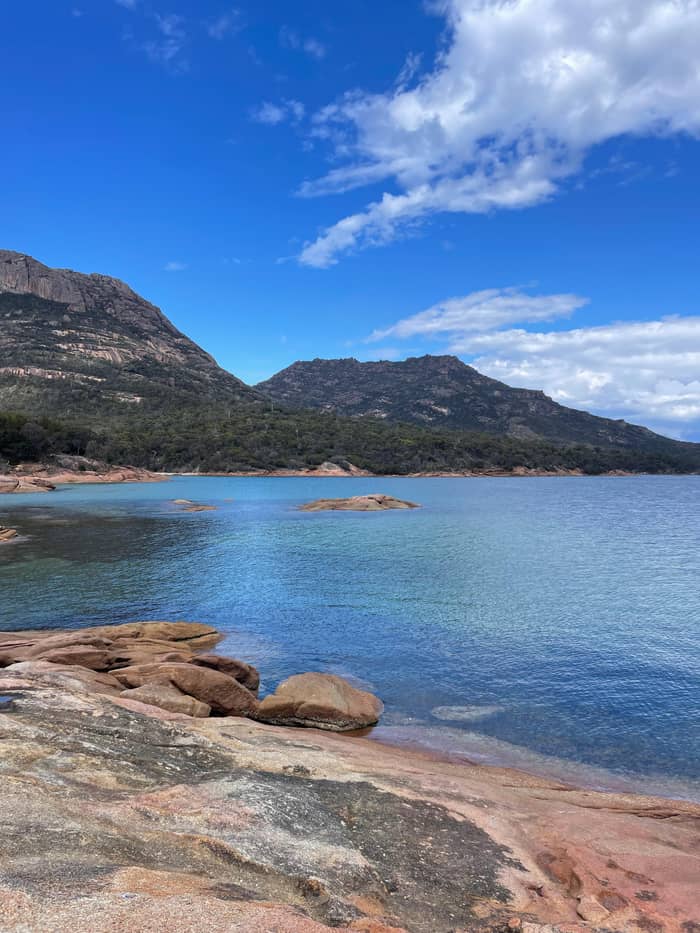
Fit and dry days
The highest view
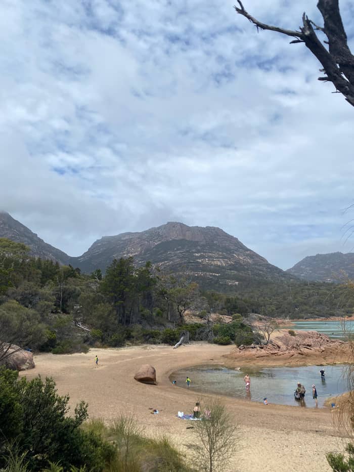
Half a day
Sand underfoot
From the platforms the bay curves away below you, a white arc of sand between granite headlands. The parks service gives the reason for the shape: the peninsula is a pair of worn granite masses, the Hazards on one side and Mount Graham with Mount Freycinet on the other, linked by the strip of sand that makes the bay.50 The park's management plan calls that join an unusually wide and well developed tombolo, with dunes and a lagoon behind the sand.45 It is a geology lesson laid out at your feet.
Behind you rise the peaks you climbed through. The management plan has Mt Mayson standing 420 metres and Mt Amos 445 metres, with Mt Dove at 485 metres and Mt Parsons at 331 metres completing the Hazards.51 It singles the range out as Tasmania's finest showcase of granite worn into shape on a grand scale.52 Late light turns that granite orange and pink, and the afternoon can photograph as well as the morning.
Keep an eye on the water. The parks service notes that some walkers get the bonus of whales or dolphins in the bay, and from the Wineglass Bay and Cape Tourville lookouts you may see white-bellied sea-eagles or Australasian gannets diving for food.53,54 Binoculars earn their weight on this walk. If the sea is calm and empty, the colors of the water are the show: turquoise over sand, deep blue further out.
The walk in order
Car park
Use the toilets and the tap at the walking tracks car park.10,11
Lower track
The path climbs through coastal woodland past granite boulders.16
Middle section
Expect short steep sections and many steps; use the resting seats.2,17
The saddle
The lookout sits in a pass through the peaks.18
Platforms
From the saddle the platforms are close; stay within the barriers.19,20
Return
The return makes the whole walk 2.6 km.1
Choosing between Mt Amos or the Wineglass Bay Lookout comes down to fitness, weather and nerve. Mount Amos is a 3 hours return, 3.6km climb rated Grade 4, and the parks service says it is only suitable for physically fit, well-equipped walkers.5,28 Discover Tasmania adds that the track needs some scrambling on steep granite slabs, and that its summit gives the loftiest view of the bay, earned the hard way.55,56
The warnings on Mount Amos are specific. The track crosses very steep, slippery rock slabs that are extremely dangerous when wet, and the parks service says nobody should attempt it in rain or when rain looks likely.26,6 Up top there is no shelter, and the weather can turn fast.57 The walk is not recommended for the elderly or young children, and there are no facilities on the track beyond the toilet at the car park.27,58
In practice the decision is simple. If the rock is dry, the forecast is settled and everyone in your group is fit and confident on bare slabs, Mount Amos gives a view that few visitors see. If any of those is missing, take the lookout track, which delivers the classic view in about half the time with a made path underfoot. If you are staying a few days, do the lookout on arrival and keep Mount Amos for a clear, dry morning.
Video
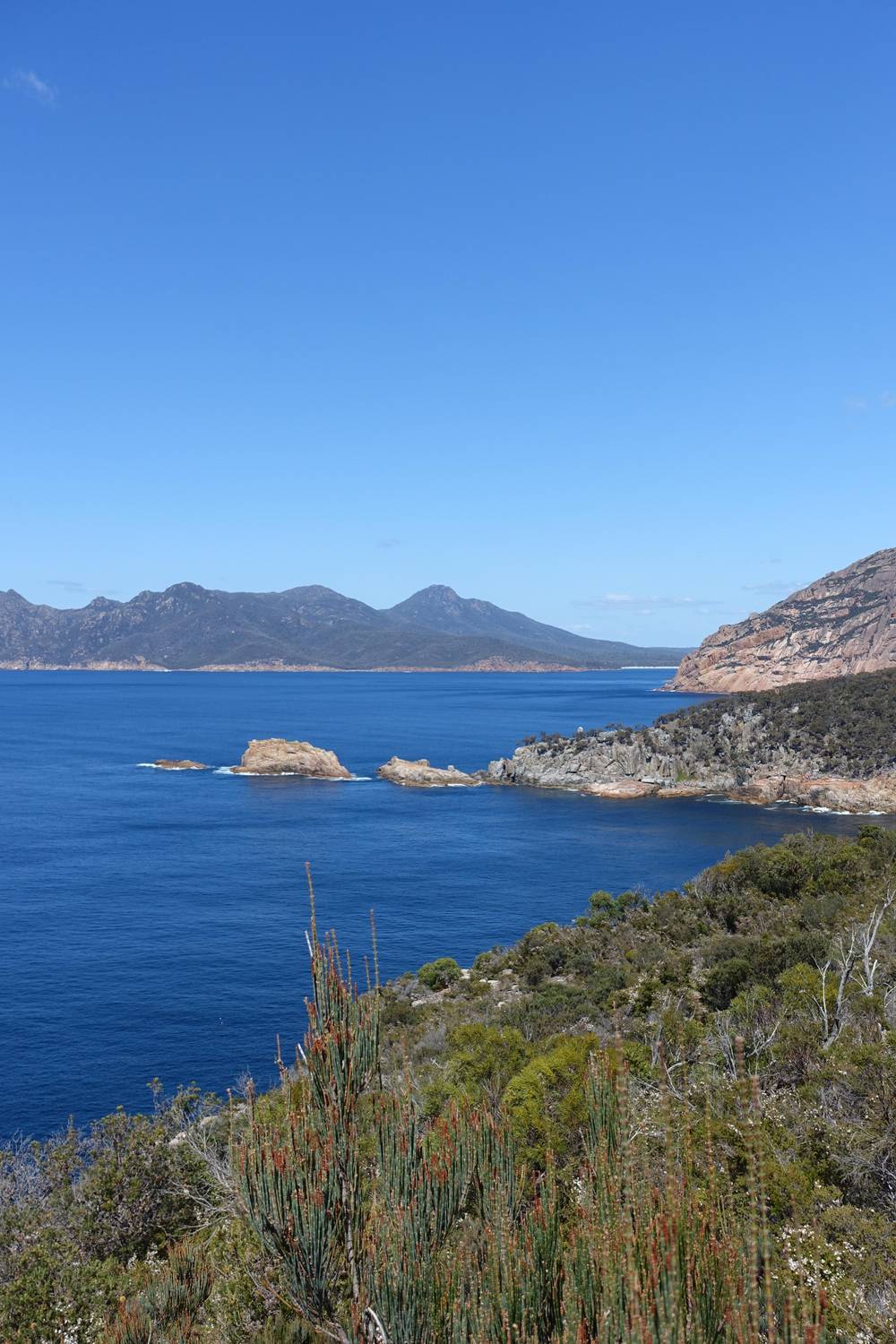
Sue Where Why What on YouTube · Tap play to load the video; not before.
A beautifully constructed track takes you up through coastal woodland, past striking granite boulders, to the lookout
Pack and plan
This is the most traversed track inside the park, and Discover Tasmania suggests walking it in the early morning or the afternoon to avoid the busy midday period.59,4 An early start also gives you softer light on the bay and cooler air for the climb, and the steep middle section is far kinder before the sun is high. Late afternoon has its own reward: the granite above the saddle warms in color as the shadows lengthen.
Your timing also depends on how you arrive. This site's tour from Hobart gives the lookout 1.5 hours and pairs it with Cape Tourville and Honeymoon Bay, with free cancellation up to 24 hours ahead and prices from $110. Children under 8 years cannot join it, a point to check before you plan a family outing. A self-drive visit lets you choose your hour; a tour handles the long drive from the city.
Season matters less than the hour. The parks service reminds walkers that Tasmanian weather can turn in any month, and it asks them to prepare for a bad day as well as a fine one.60 In summer, sun protection is the priority; Discover Tasmania says UV is high from September to April.61 In winter, cooler air makes the climb easier, but a windproof layer earns its place in the pack, and the platforms can be cold when the wind comes off the sea.
Freycinet walks run over steep granite and loose gravel, and the parks service recommends sturdy footwear.48 Leave thongs and smooth-soled sandals in the car; the descent is where they slip. The park also has hazardous cliffs and unpatrolled beaches, and children need watching at all times.30 Record your plans in the walker log books at the start, a habit the parks service asks of every walker.62
Wildlife is part of the walk. Possums are drawn to food and will investigate unattended bags, and the parks service asks visitors not to feed animals, which makes them sick.63,64 Keep at least two metres from native animals, and never hand a wallaby a snack: processed food can cause lumpy jaw, a painful bone growth.49,65 You may well meet Bennetts wallabies, pademelons or echidnas along the way, so walk quietly.66
A few rules catch visitors out. Drones are not permitted in any Tasmanian national park or reserve, including above the lookout.67 Pets, dogs included, are generally barred from national parks, with assistance dogs the exception.68 Carry your rubbish back to the car park, keep to the made track, and leave the granite as you found it for the next walker. The bay looks untouched from above only while every visitor treats it that way.
FAQ
Those are the hours Discover Tasmania recommends for dodging the lunchtime crush.4
Dogs and other pets are generally not allowed in Tasmanian national parks; assistance dogs are.68
Sources
More to read
Planning a day at Wineglass Bay? A real person answers here.